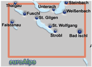
mayr
76
1:35000
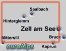
mayr
72
1:25000
These are some of the mayr maps that cover the resorts.
Note: The area or resort may be on the edge of some maps.
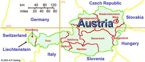
The pictures show the approximate area covered. The maps are different scales and the size (of paper) also varies.
Mayr Maps - Wanderkarten
Austria
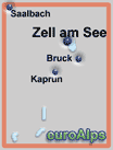
mayr
74
1:35000
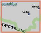
mayr
89
1:35000
mayr
70
1:35000
A good range is available from Amazon. You will find links to the Amazon UK site, Amazon US, Amazon CA, Amazon IT and Amazon Germany sites. Not all books & maps are available from each site.
For information about how English speaking Customers can order from Amazon Germany, click here.
Mayr Walking Maps
Bregenzerwald, Großes Walsertal - Bezau, Damüls, Egg, Au
Arlberg, Lech, Steeg, Warth - St. Anton am Arlberg, St. Christoph am Arlberg
Bludenz, Brandner Tal - Lünersee, Rätikon-Höhenweg
Montafon - Schruns, Tschagguns, St. Gallenkirch
mayr
85
1:35000
mayr
86
1:35000
mayr
87
1:35000
mayr
88
1:35000
Salzburger Saalachtal - Lofer, St. Martin, Unken, Weißbach
mayr
71
1:35000
Großarltal - Großarl, Hüttschlag
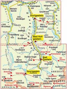
Gasteiner Tal - Bad Gastein, Bad Hofgastein, Dorfgastein, Sportgastein
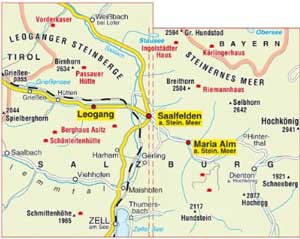
Saalfelden, Maria Alm XL, Saalfelden, Leogang, Maria Alm
Gasteiner Tal XL, Bad Gastein, Sportgastein, Bad Hofgastein, Dorfgastein, Rauriser Tal, Großarltal
Dachsteingebebirge - Hallstätter See XL, Gosau - Obertraun - Ramsau am Dachstein
Attersee - Mondsee - Fuschlsee - Irrsee XL, Westliches Salzkammergut
Traunsee - Almtal XL, Östliches Salzkammergut
Bad Ischl - Wolfgangsee XL, im Herzen des Salzkammergut
Ausseerland XL, Totes Gebirge - Altaussee - Grundlsee - Tauplitz
mayr
78
1:35000
mayr
79
1:35000
mayr
570
1:25000
mayr
579
1:25000
mayr
510
1:25000
mayr
520
1:25000
mayr
530
1:25000
mayr
540
1:25000
mayr
550
1:25000
|
This page |
First page |
|
|
Mayr produce a range of maps including walking / hiking maps. They also produce road maps, city maps and panorama maps. Walking maps have scales from 1:25000 to 1:40000. The new mayr XL Edition maps are 1:25000 double sided maps and are tear and water resistant with large size print / symbols.
Mayr was started by Walter Mayr in 1977 and bought by Kompass Maps in 2002.
This list is believed to be correct, but there may be some current maps missing or some out of print.
maps: 16.4 x 10cm
Some new XL edition maps cover the same area as existing 1:25000 scale maps, for example map 79 & map 579.


Similar area, but different scale, to map 579, below.
Similar area, but different scale, to map 79, above.
Similar area, but different scale, to map 570, below.
Similar area, but different scale, to map 70, above.
This is a mayr XL Edition map. It is a double sided map and is tear and water resistant.
It covers the area south of Bad Ischl, the town of Hallstatt and lake, and village of Ramsau am Dachtein, .
This is a mayr XL Edition map. It is a double sided map and is tear and water resistant.
It covers the lakes (Altaussee - Grundlsee) and the Totes Gebirge range south east of Bad Ischl.
This is a mayr XL Edition map. It is a double sided map and is tear and water resistant. It covers the lakes (Attersee - Mondsee - Fuschlsee - Irrsee) in the western part of the Salzkammergut region, east of Salzburg.
This is a mayr XL Edition map. It is a double sided map and is tear and water resistant.
It covers the Gastein valley 25km south east of Zell am See.
This is a mayr XL Edition map. It is a double sided map and is tear and water resistant.
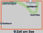
It covers the area north of Zell am See.
This is a mayr XL Edition map. It is a double sided map and is tear and water resistant.
It covers the lakes (Traunsee) in the eastern part of the Salzkammergut region, east of Salzburg.
This is a mayr XL Edition map. It is a double sided map and is tear and water resistant.
It covers the lakes (Wolfgangsee) and the town of Bad Ischl in the central part of the Salzkammergut region, east of Salzburg.
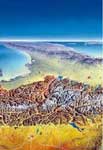
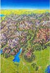
Mayr Panorama / Poster
Poster Alpen - Adria Panorama
Poster Die Alpen Panorama - H.C. Berann
mayr
191
mayr
195
Mayr publish panoramas of the Alps. They come rolled in a tube.
Size: 98 x 69 cm
Size: 85 x 50 cm
Amazon DE
Amazon US
Amazon CA
© 2005-2025
A Fielding
All Rights Reserved
Amazon UK
Amazon IT
