Books and Maps
Map Publishers
There are a number of map publishers that make maps suitable for a range of activities. The ones listed here are suitable for walking / hiking but a lot also have bike and skiing.
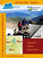
Alpenwelt Verlag
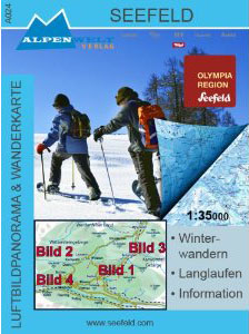
These maps cover Austria and north Italy (Sudtirol) with a few in Germany and Switzerland. There are a range of scales and some are waterproof. There is one winter map (Seefeld, shown right).
BEV ÖK
Produced by the Austrian “Bundesamt für Eich- und Vermessungswesen” (Federal Office for Calibration and Surveys), these maps show lots of detail with scales of 1:25000 & 1:50000.. There are two versions of each map, one with the walking paths shown in red.
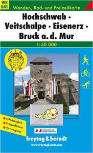
freytag & berndt
freytag & berndt produce a range of walking maps. There have walking paths, huts & restaurants, bus stops marked. New editions have a 1km UTM grid marked. Some come with a small book in German with tourist information, walks, mountain huts, a list of summits etc. with co-ordinates for GPS receivers. Some also have bike routes, ski tour routes, cross country ski tracks marked. They come in a plastic sleeve.
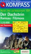
Kompass
Walking maps from Kompass show walking paths, huts & restaurants. New editions have a 1km UTM grid marked. Some come with a small book in various languages (German, Italian, English) or just German with tourist information, walks, mountain huts, etc. Some also have bike routes, ski tour routes, cross country ski tracks marked. Some have a Panorama on the back. They come in a plastic sleeve. Kompass also produce a range of Digital Maps for use with a PC and GPS receiver.
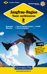
Hallweg - Kümmerly+Frey
Mainly Switzerland, these walking maps show walking paths, huts & restaurants. The show a co-ordinate system suitable for use with GPS receivers. They come in a plastic sleeve. Most have a scale of 1:60000.
Hallweg - Valser
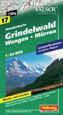
Mainly Switzerland, these walking maps show walking paths, huts & restaurants. The show a co-ordinate system suitable for use with GPS receivers. They are waterproof and come in a plastic sleeve. Most have a scale of 1:50000.
Mayr
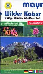
Mayr walking maps show walking paths, huts & restaurants. Some Mayr maps come with a small book in various languages (German, Italian, French, English) or just German with tourist information, walks, mountain huts, etc. Some also have bike and mountain bike routes marked. Some have a Panorama and pictures of flora and fauna on the back. They are folded pocket size and come in a plastic sleeve.
Ordnance Survey - OS Explorer Maps
Covering the UK, and at a scale of 1:25000, the Ordnance Survey Explorer Maps are detailed and show all features needed for walking & hiking in the UK.
Österreichischer Alpenverein / Deutscher Alpenverein
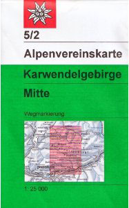
These walking maps are produced by the Austrian Alpine Club and the German Alpine Club. They are very detailed with contours, Long & Lat, UTM, and a lot of other features. Paths and Alpine Club Huts are marked. Some maps are also available in a skiing version with piste and ski trails marked. They come in a plastic sleeve.
Swiss Bundesamt fur Landestopographie
The Swiss Bundesamt fur Landestopographie produce several series of maps including several suitable for walking / hiking. The 1:25000 and 1:50000 maps provide a lot of information. The 1:50000 Hiking maps are produced with the Swiss Hiking federation and provide additional information for walking. The 1:5000 Skiing maps are produced with the Swiss Ski Federation and show additional information for skiers / snowboarders. There is also a 1:25000 series of maps with additional tourist information available covering popular tourist regions.
Map Features
Click here for Map Feature Information.
There are lots of Books and Maps that describe and explain every aspect of visiting and walking and hiking in the European Alps and surrounding countries.
A good range is available from Amazon. You will find links to the Amazon UK site, Amazon US, Amazon Canada, Amazon Germany (DE), and Amazon Italy (IT) sites. Not all books & maps available from each site.
For information about how English speaking Customers can order from Amazon Germany, click here.
Books
Euroalps is a participant in the Amazon Europe S.à r.l. Associates Programme, an affiliate advertising programme designed to provide a means for sites to earn advertising fees by advertising and linking to Amazon.co.uk, Amazon.de, Amazon.it.
Euroalps ist Teilnehmer des Partnerprogramms von Amazon Europe S.à r.l. und Partner des Werbeprogramms, das zur Bereitstellung eines Mediums für Websites konzipiert wurde, mittels dessen durch die Platzierung von Werbeanzeigen und Links zu Amazon.co.uk, Amazon.de, Amazon.it Werbekostenerstattung verdient werden kann.
Euroalps partecipa al Programma Affiliazione Amazon Europe S.à r.l., un programma di affiliazione che consente ai siti di percepire una commissione pubblicitaria pubblicizzando e fornendo link al sito Amazon.co.uk, Amazon.de, Amazon.it.
- Travel Guides
- Accommodation Guides
- Travel Literature
- Railway Travel
- Walking / Hiking Guides
- Climbing Guides
- Skiing and Snowboarding Guides
- Bird watching, Flora & Fauna Guides
- Panoramic Maps
- Satellite Images & Aerial Photos
- Road Maps & Atlases
- Regional Maps
- Tourist Maps
- Town Street Maps
- Public Transport Maps - Bus, Railway
- Walking / Hiking & Detailed Topographic Maps
- Cycling Maps
- Skiing Maps
- Software - CD-ROM / Palm / Pocket / PC & GPS Mapping
Maps
|
|
|
Austria |
|
|
|
|
||||
|
Switzerland |
||||
|
|
|
|||
Every map shows a range of information, in different formats, making some more suitable for walking or hiking.
There are several maps, suitable for walking and hiking, covering each of the Resorts.
Amazon DE
Amazon US
Amazon CA
© 2005-2025
A Fielding
All Rights Reserved
Amazon UK
Amazon IT
