Söll, Tirol, Austria
Lat 47.50358 N; Long 12.19180 E; Altitude: 703 m. Postcode: A-6306
Söll is in the Tirol (Tyrol) region of Austria and lies at the western end of a West - East valley near the Wilder Kaiser and the Hohe Salve mountains. It is part of the “BergWelt Wilder Kaiser” region together with Ellmau, Scheffau, Going, Hopfgarten im Brixental, Itter, Kelchsau, Brixen im Thale, Westendorf, Angath, Angerberg, Mariastein, Kirchbichl and Wörgl. The town of Wörgl is to the West and the villages of Scheffau, Ellmau, and Going are to the East of Söll with St. Johann, north of Kitzbühel, at the Eastern end. The main road (178) passes to the south of the village.
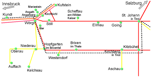
This diagrammatic map is a guide to where Söll is in relation to the nearby resorts, roads, lakes and mountains etc.
Not to scale and not all details are shown.
Söll Interactive Map
Söll Diagrammatic Map
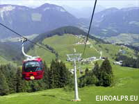
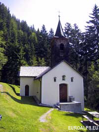
Söll from the summit of Hohe Salve
Kompass
WK 29
1:50000
Kitzbüheler Alpen
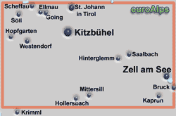
Kaisergebirge
Kompass
WK 9
1:50000
Wanderkarte Kufstein, Kaisergebirge, Kitzbühel
freytag & berndt
WK 301
1:50000
Wanderkarte - Brixental, Wörgl, Kitzbühel
freytag & berndt
WK 302
1:50000
Kirchberg in Tirol, Aschau im Spertental
mayr
54
1:25000
Kitzbüheler Alpen, west sheet
Alpenvereins karte
34/1
1:50000
Brixental, Brixen i. Thale, Westendorf, Hopfgarten, Itter, Kelchsau
mayr
56
1:25000
Wilder Kaiser, Going, Ellmau, Scheffau, Söll
mayr
51
1:25000
Kufstein, Walchsee, St. Johann in Tirol
Kompass
WK 09
1:25000
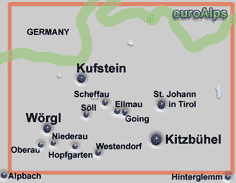
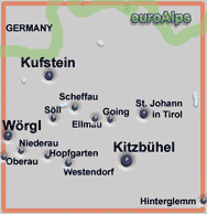
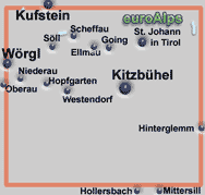
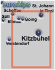
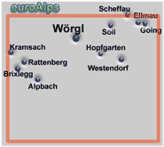
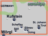
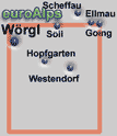
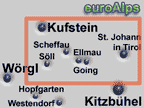
These are some of the paper maps that cover the area.
Note: The area or resort may be on the edge of some maps.
The pictures show the approximate area covered. The maps are different scales and the size (of paper) also varies.
Left click over the map to move the area shown.
The Kompass range of digital maps allow you to view the map on a PC, print sections out, plot tracks and waymarks and transfer them to and from GPS receivers. You can zoom into a maximum map scale of 1:10000. Most also allow you to view the terrain and your track and photos in 3D and to “fly” along your track. Some also include a search function for locations, huts, summits.
These are some of the digital maps that cover the area. More Kompass Digital Maps
Note: The area or resort may be on the edge of some maps.
The pictures show the approximate area covered.
Tirol 3D digital
DIGITAL MAP GPS 4292
This Kompass map covers the Austrian province of Tyrol; (Tirol - Nordtirol & Osttirol)
Österreich 3D digital
DIGITAL MAP GPS 4309
This Kompass digital map covers the whole of Österreich (Austria).
Other Kompass Maps Other mayr Maps Other freytag & berndt Maps Other Alpine Club Maps
Paper Maps
Digital Maps
Covers Kufstein, Wörgl, Söll, Ellmau, Scheffau, St Johann in Tirol.
Covers Kufstein, Wörgl, Söll, Ellmau, Scheffau, Kitzbühel, St Johann in Tirol, Westerndorf, Going, Hopfgarten, Oberau, Niederau.
mayr
451
1:25000
This is a mayr XL Edition map. It is a double sided map and is tear and water resistant.
© 2005-2025
A Fielding
All Rights Reserved
|
|
| Subscribe to Hiking Alps |
| Visit this group |
