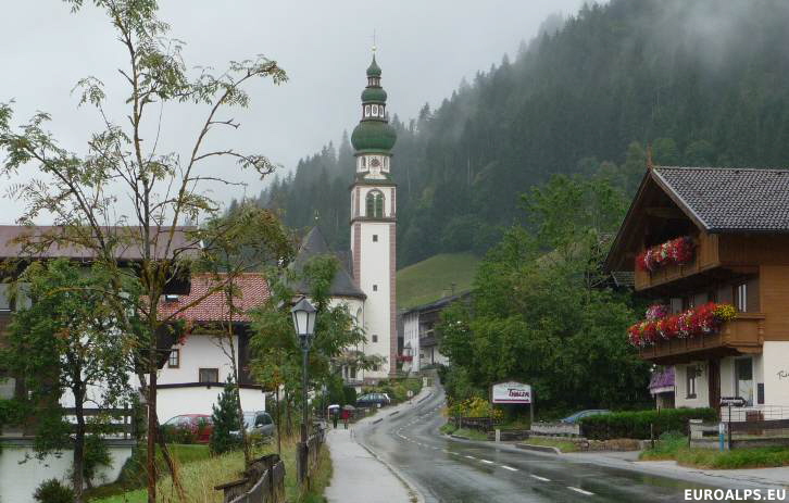
Oberau, Wildschönau, Tirol, Austria

Oberau Location
Click here for a Region Map and details of walking / hiking maps.
Oberau is in the Kitzbüheler Alpen in the Tirol (Tyrol) region of Austria and lies in the middle of a West - East valley (Wildschönau) which is south-west of the town of Wörgl.
Further along the valley to the west are the villages of Mühltal, Thierbach and Auffach. To the east is Niederau. East of Niederau are the villages of Söll and Westendorf.
The main road from Wörgl runs along the valley and ends at Auffach.
Walking / Hiking in the Oberau Area
North of Oberau there are some moderate walks down to Wörgl and Kundl. South of Oberau there are some harder walks up to the Marchbachjoch with a gondola down to Niederau. Along the valley there are some good walks to Niederau, Auffach and the other villages. From Auffach there are some walks on the Schazberg (gondola) with a walk or lift down to Alpbach. The gorge walk from Mühltal down to Kundl is good.
The Tourist Office may offer free led walks.
Skiing in the Oberau Area
The main downhill skiing area near Niederau is south on the Marchbachjoch. There is also skiing in Auffach on the Schatzberg. There are gondolas in both areas. There is a beginners area in Oberau.
Niederau is part of the SkiWelt Wilder Kaiser-Brixental and the Kitzbüheler Alpen Ski Region so the skiing area covers a large area.
The ski areas of Alpbach and Wildschönau were connected in 2012 by a new lift (Verbindungsbahn) from Inneralpbach to the summit of Schatzberg. This combined ski area is known as Ski Juwel.
Kitzbüheler Alpen Ski Region comprises of:
- Skigebiet Kitzbühel (Kitzbühel, Kirchberg, Jochberg, Pass Thurn, Mittersill Oberpinzgau)
- SkiWelt Wilder Kaiser-Brixental, (Brixen im Thale, Ellmau, Going, Hopfgarten, Itter, Kelchsau, Scheffau, Söll, Westendorf)
- Skiregion Schneewinkel (St. Johann in Tirol, Oberndorf, Kirchdorf, Erpfendorf, Fieberbrunn, St. Ulrich, St. Jakob, Hochfilzen, Waidring, Reit im Winkl)
- Hochtal Wildschönau (Niederau, Oberau, Auffach, Thierbach)
- Skigebiet Alpbachtal (Alpbach, Reith, Kramsach).
Oberau Walking / Hiking Maps
There are several maps that cover the area at different scales suitable for walking, hiking and exploring the area.
Click here for Oberau Map Information.
Oberau Tourist Information
The tourist office is on the road between Niederau and Oberau.
Tourismusinformation Wildschönau,
Hauserweg,
Oberau 337
A-6311 Wildschönau
Austria
Tel: +43 (0) 5339 8255
E-Mail
Airports (Flughafen)
The nearest airport to Oberau is Innsbruck.
- Innsbruck: 80 km - 1h 00 mins
- Salzburg: 120 km - 1h 25 mins
- Munich: 110 km - 1h 10 mins
Rail Stations (Bahnhof)
The nearest main train station is Wörgl 12 km to the North. Buses run from Oberau to Wörgl.
ÖBB (English) also has bus information.
Buses
Buses run along the valley from Wörgl to Auffach calling at Niederau and the villages of Oberau, Mühltal and Auffach.
ÖBB (English) also has train information.
VVT (Verkehrsverbund Tirol) also has train information.
Cable Cars - Chair Lifts
The main lift in Niederau goes to the summit of Marchbachjoch, 1496m. There is also a lift in Auffach (Schatzberg, 1776m).
© 2005-2025
A Fielding
All Rights Reserved
|
|
| Subscribe to Hiking Alps |
| Visit this group |
