Galtür, Tirol, Austria
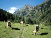
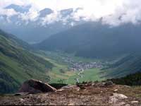
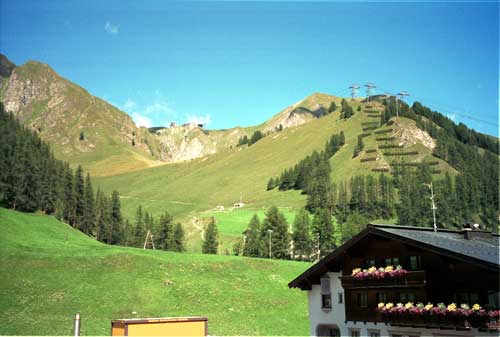
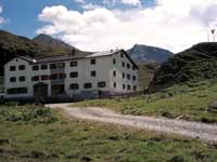
Galtür Location
Click here for a Region Map and details of walking / hiking maps.
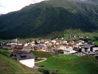
Galtür is in the Tirol (Tyrol) region of Austria and lies in the Paznaun valley (Paznauntal) south of St. Anton, south west of the village of Ischgl and just a few km north of the border with Switzerland. There are banks with ATM machines and a supermarket.
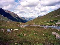
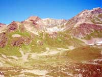
Walking / Hiking in the Galtür Area
There are about km of paths. The Tourist Office may offer free led walks.
Galtür Hiking / Walking Maps
There are several maps that cover the Galtür area at different scales suitable for walking, hiking and exploring the area.
Click here for Galtür Map Information.
Galtür Tourist Information
Tourismusverband Paznaun
Gemeindehaus Nr. 39
A-6563 Galtür, PO Box 6563, Austria
Tel +43 (0) 5443 8521
Fax +43 (0) 5443 8521 76
E-Mail: info@galtuer.com
Airports (Flughafen)
The nearest airport to Galtür is Innsbruck.
- Innsbruck: 120 km - 1h 15 mins
- Salzburg: 300 km - 2h 45 mins
- Munich: 210 km - 2h 30 mins
Rail Stations (Bahnhof)
The nearest train station is Landeck, 32 km and St. Anton 50 km
ÖBB (English) also has bus information.
Buses
Buses run along the valley.
ÖBB (English) also has train information.
VVT (Verkehrsverbund Tirol) also has train information.
Cable Cars - Chair Lifts
Bergbahnen Silvretta Galtür
E Mail: info@bergbahnen-galtuer.at
WEB: Bergbahner Galtür
© 2005-2025
A Fielding
All Rights Reserved
|
|
| Subscribe to Hiking Alps |
| Visit this group |
- Home
- Countries
- eurounion
- austria
- Alpbach
- Altmünster
- Bad Aussee
- Bad Ischl
- Bruck an der Großglocknerstrasse
- Ebensee
- Ellmau
- Fieberbrunn
- Filzmoos
- Fuschl
- Galtür
- Gmunden
- Hallstatt
- Igls
- Innsbruck
- Kaprun
- Kitzbühel
- Kufstein
- Mayrhofen
- Mittersill
- Mutters
- Niederau
- Oberau
- Obergurgl
- Pertisau
- Ramsau
- Rattenberg
- Reith im Alpbachtal
- Saalbach-Hinterglemm
- Salzburg
- Schladming
- Seefeld
- Söll
- St. Anton
- St. Gilgen
- St. Johann
- St. Wolfgang
- Strobl
- Telfes
- Traunkirchen
- Waidring
- Westendorf
- zellsee
- switzerland
- Before You Travel
- Holiday Paperwork
- Holiday Travel
- Accommodation
- Walking Clothes
- Walking Equipment
- Books & Maps
- mapinfo
- Kuemmerly Frey Maps
- Valser Maps
- Alpine Club maps
- mayr maps
- freytag berndt maps
- Kompass maps
- Kompass Paper Maps
- Kompass Digital Maps
- Kompass Map 4309
- Kompass Map 4290
- Kompass Map 4291
- Kompass Map 4292
- Kompass Map 4293
- Kompass Map 4294
- Kompass Map 4295
- Kompass Map 4296
- Kompass Map 4297
- Kompass Map 4001
- Kompass Map 4003
- Kompass Map 4004
- Kompass Map 4025
- Kompass Map 4026
- Kompass Map 4032
- Kompass Map 4043
- Kompass Map 4044
- Kompass Map 4052
- Kompass Map 4056
- Kompass Map 4066
- Kompass Map 4070
- Kompass Map 4102
- Kompass Map 4187
- Kompass Map 4191
- Kompass Map 4221
- Kompass Map 4230
- Kompass Map 4231
- Kompass Map 4232
- Kompass Map 4233
- Kompass Map 4234
- Kompass Map 4235
- Kompass Map 4237
- Kompass Map 4239
- Kompass Map 4240
- Kompass Map 4241
- Kompass Map 4242
- Kompass Map 4243
- Kompass Map 4250
- Kompass Map 4251
- Kompass Map 4331
- Kompass Map 4334
- Kompass Map 4371
- Kompass Map 4372
- Kompass Map 4650
- Kompass Map 4701
- Kompass Map 4705
- Kompass Map 4737
- Kompass Map 4750
- Kompass Map 4770
- Kompass Map 4804
- Kompass Map 4837
- Kompass Map 4850
- Kompass Map 4852
- Kompass Map 4853
- Kompass Map 4854
- Alpenwelt maps
- Resorts
- Walks, Hikes
- Alpine Fauna
- Alpine Flora
- Mountain Huts, Cafés
- Technology
- Privacy, cookies
