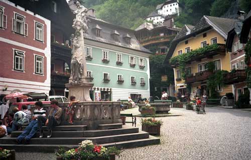
Hallstatt, Salzkammergut, Austria

Hallstatt Location
Click here for a Region Map of Hallstatt and details of walking / hiking maps.
Hallstatt is in Oberösterreich, to the south east of Salzburg in the Salzkammergut. It is on the western side of Hallstätter See. The lakes of Altausseer See, Toplitzsee and Grundlsee and the village of Bad Aussee lie to the east and Bad Ischl lies to the north. The main road on the west side of the lake by-passes the village through a tunnel. There is a ferry across the lake to the train station.
Walking / Hiking in the Hallstatt Area
In the Hallstatt area there are lots of paths. The Tourist Office may offer free led walks.
Hallstatt Hiking / Walking Maps
There are several maps that cover the area at different scales suitable for walking, hiking and exploring the area. Click here for details.
Skiing in the Hallstatt Area
The nearest ski area is the Freeride Arena Krippensteinin in Obertraun, about 5 km south east of Hallstatt on the south western edge of the lake.
In Gosau, about 18 km to the west of Hallstatt, is the Skiregion Dachstein-west.
A couple of km south of Hallstatt is the Echerntal with a small ski area for beginners (Skilift Speiger).
Hallstatt Tourist Information
Tourismusverband Hallstatt
Seestraße 169
im Kultur- und Kongresshaus
A- 4830 Hallstatt,
Postfach A- 4830,
Österreich
Salzkammergut Region
Airports near to Hallstatt (Flughafen)
The nearest airport to Hallstatt is Salzburg.
- Innsbruck: 280 km - 3h 00 mins
- Salzburg: 80 km - 1h 15 mins
- Munich: 230km - 2h 30 mins
Rail Stations (Bahnhof) and Ferries
There is no train station in Hallstatt village. The nearest station (called Hallstatt) is on the other side of the lake.
There are ferry connections acoss the lake.
ÖBB (English) also has bus information.
Buses
There are a number of bus routes.
ÖBB (English) also has train information.
Cable Cars - Chair Lifts
There are no cable cars or chair lifts in Hallstatt. The nearest one is in Obertraun, about 5 km south east of Hallstatt on the south western edge of the lake.
© 2005-2025
A Fielding
All Rights Reserved
|
|
| Subscribe to Hiking Alps |
| Visit this group |
- Home
- Countries
- eurounion
- austria
- Alpbach
- Altmünster
- Bad Aussee
- Bad Ischl
- Bruck an der Großglocknerstrasse
- Ebensee
- Ellmau
- Fieberbrunn
- Filzmoos
- Fuschl
- Galtür
- Gmunden
- Hallstatt
- Igls
- Innsbruck
- Kaprun
- Kitzbühel
- Kufstein
- Mayrhofen
- Mittersill
- Mutters
- Niederau
- Oberau
- Obergurgl
- Pertisau
- Ramsau
- Rattenberg
- Reith im Alpbachtal
- Saalbach-Hinterglemm
- Salzburg
- Schladming
- Seefeld
- Söll
- St. Anton
- St. Gilgen
- St. Johann
- St. Wolfgang
- Strobl
- Telfes
- Traunkirchen
- Waidring
- Westendorf
- zellsee
- switzerland
- Before You Travel
- Holiday Paperwork
- Holiday Travel
- Accommodation
- Walking Clothes
- Walking Equipment
- Books & Maps
- mapinfo
- Kuemmerly Frey Maps
- Valser Maps
- Alpine Club maps
- mayr maps
- freytag berndt maps
- Kompass maps
- Kompass Paper Maps
- Kompass Digital Maps
- Kompass Map 4309
- Kompass Map 4290
- Kompass Map 4291
- Kompass Map 4292
- Kompass Map 4293
- Kompass Map 4294
- Kompass Map 4295
- Kompass Map 4296
- Kompass Map 4297
- Kompass Map 4001
- Kompass Map 4003
- Kompass Map 4004
- Kompass Map 4025
- Kompass Map 4026
- Kompass Map 4032
- Kompass Map 4043
- Kompass Map 4044
- Kompass Map 4052
- Kompass Map 4056
- Kompass Map 4066
- Kompass Map 4070
- Kompass Map 4102
- Kompass Map 4187
- Kompass Map 4191
- Kompass Map 4221
- Kompass Map 4230
- Kompass Map 4231
- Kompass Map 4232
- Kompass Map 4233
- Kompass Map 4234
- Kompass Map 4235
- Kompass Map 4237
- Kompass Map 4239
- Kompass Map 4240
- Kompass Map 4241
- Kompass Map 4242
- Kompass Map 4243
- Kompass Map 4250
- Kompass Map 4251
- Kompass Map 4331
- Kompass Map 4334
- Kompass Map 4371
- Kompass Map 4372
- Kompass Map 4650
- Kompass Map 4701
- Kompass Map 4705
- Kompass Map 4737
- Kompass Map 4750
- Kompass Map 4770
- Kompass Map 4804
- Kompass Map 4837
- Kompass Map 4850
- Kompass Map 4852
- Kompass Map 4853
- Kompass Map 4854
- Alpenwelt maps
- Resorts
- Walks, Hikes
- Alpine Fauna
- Alpine Flora
- Mountain Huts, Cafés
- Technology
- Privacy, cookies
