Söll, Tirol, Austria
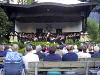
Bundesmusikkapelle Soell
Music from Söll
Söll Location
Click here for a Region Map and details of walking / hiking maps.
Söll is in the Tirol (Tyrol) region of Austria and lies at the western end of a West - East valley near the Wilder Kaiser and the Hohe Salve mountains. It is part of the “BergWelt Wilder Kaiser” region together with Ellmau, Scheffau, Going, Hopfgarten im Brixental, Itter, Kelchsau, Brixen im Thale, Westendorf, Angerberg, Mariastein, Angath, Kirchbichl and Wörgl. The town of Wörgl is to the West and the villages of Scheffau am Wilden Kaiser, Ellmau, and Going am Wilden Kaiser are to the East of Söll with St. Johann, north of Kitzbühel, at the Eastern end. The main road (178) passes to the south of the village.
Walking / Hiking in the Söll Area
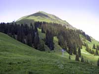
North of Söll there are some moderate walks around the Hintersteiner See area. Harder walks are a bit further north in the Wilderkaiser mountain range. To the south the Kitzbüheleralpen range offers some good walks to Hohe Salve (1827m) and down to Brixen and Hopfgarden. There are also good walks both in the valley and up higher between Söll and Scheffau, Ellmau and Going.
The Tourist Office may offer free led walks. A good map to use is Mayr 451.
Skiing in the Söll Area
The main downhill skiing area near Söll is south of the Hohe Salve area. Söll is part of the SkiWelt Wilder Kaiser-Brixental and the Kitzbüheler Alpen Ski Region so the skiing area covers a large area.
Kitzbüheler Alpen Ski Region comprises of:
- Skigebiet Kitzbühel (Kitzbühel, Kirchberg, Jochberg, Pass Thurn, Mittersill Oberpinzgau)
- SkiWelt Wilder Kaiser-Brixental, (Brixen im Thale, Ellmau, Going, Hopfgarten, Itter, Kelchsau, Scheffau, Söll, Westendorf)
- Skiregion Schneewinkel (St. Johann in Tirol, Oberndorf, Kirchdorf, Erpfendorf, Fieberbrunn, St. Ulrich, St. Jakob, Hochfilzen, Waidring, Reit im Winkl)
- Hochtal Wildschönau (Niederau, Oberau, Auffach, Thierbach)
- Skigebiet Alpbachtal (Alpbach, Reith, Kramsach).
Söll Walking / Hiking Maps
There are several maps that cover the area at different scales suitable for walking, hiking and exploring the area.
Click here for Söll Map Information. A good map to use is Mayr 451.
Söll Tourist Information
Tourismusverband Söll
Dorf 84
A-6306 Söll, Austria
Tel: +43 (0) 5333 5216
Fax: +43 (0) 5333 6180
E-Mail: info@soell.at
WEB: Skiwelt
Airports (Flughafen)
The nearest airport to Söll is Innsbruck.
- Innsbruck: 80 km - 0h 50 mins
- Salzburg: 120 km - 1h 15 mins
- Munich: 110 km - 1h 00 mins
Rail Stations (Bahnhof)
The nearest main train stations are Wörgl 10 km to the West, and St. Johann 25 km to the East. Buses run to both. Due south from Söll (over the Hohe Salve, 1827m) there are smaller train stations at Westendorf and Brixen.
ÖBB (English) also has bus information.
Buses
Buses run along the valley from Wörgl and Kufstein to St. Johann calling at Söll and the villages of Scheffau, Ellmau, and Going.
ÖBB (English) also has train information.
VVT (Verkehrsverbund Tirol) also has train information.
Cable Cars - Chair Lifts
The main lift in Söll goes to the summit of Hohe Salve, 1827m. There are also lifts in Scheffau (Brandstadl, 1650m), Ellmau (Hartkaiser-Strandseilbahn cog railway to Hartkaiser, 1555m) and Westendorf.
© 2005-2025
A Fielding
All Rights Reserved
|
|
| Subscribe to Hiking Alps |
| Visit this group |
