Zell am See, Salzburger Land, Austria
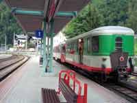
Pinzgau Bahn train arriving
at Zell am See
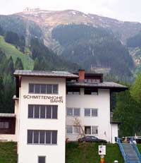
Valley station and summit station of the Schmittenhöhebahn
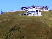
Schmittenhöhe 1965m - with chapel, summit station and hotels
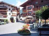
Maria Alm, 12km North East
of Zell am See
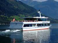
Schmittenhöhe - the ferry named after the mountain
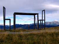
Art on the Schmittenhöhe. The chairs are 4.5m and the table 3.5m
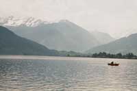
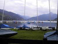
Zeller See, Zell am See
Zeller See, Zell am See
Zeller See, Zell am See
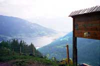
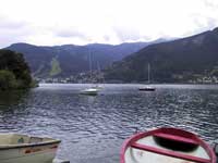
Zeller See, Zell am See from path down from Schmittenhöhe
Zell am See Location
Click here for a Region Map of Zell am See and details of walking / hiking maps.
Zell am See, Austria is a large town south / south-west of Salzburg and south-east of Kitzbühel and Saalbach-Hinterglemm. It is about 5km north-west of Bruck. It forms a hiking / ski region with Kaprun which is about 8km south-west of Zell am See. The main road (311) passes through Zell am See along the west side of the lake. The train station is on the edge of the town next to the lake.
Click here for photos of Zell am See.
Walking / Hiking in the Zell am See Area
In Zell am See there are hundreds of km of paths. The Tourist Office may offer free led walks.
Click here for walks in the Zell am See region.
Skiing in the Kaprun Area
Winter skiing is available in Zell am See on the Schmittenhöhe. In Kaprun all year skiing (apart from a few weeks for maintenance) is available on the Kitzsteinhorn Glacier.
Zell am See Maps
There are several maps that cover the Zell am See area at different scales suitable for walking, hiking and exploring the area.
Click here for Zell am See Map Information.
Zell am See Tourist Information
Zell am See & Kaprun Tourist
Brucker Bundesstrasse 1a
A-5700 Zell am See
Austria
Tel: +43 6542 7700
Fax: +43 6542 72032
Airports near to Zell am See (Flughafen)
The nearest airport to Zell am See is Salzburg.
- Innsbruck: 155 km - 2h 00 mins
- Salzburg: 95 km - 1h 15 mins
- Munich: 175 km - 2h 15 mins
Rail Stations (Bahnhof)
There is a main train station in Zell am See on the edge of the town next to the lake. The main line runs north to Saalfelden then west to Kitzbühel & Innsbruck, and south to Bruck, Bischofshofen then north to Salzburg.
The Pinzgauer Lokalbahn (PLB) (Krimmlerbahn or PinzgauBahn) runs west from Zell am See along the Pingau valley via Mittersill to near the Krimml waterfalls. From here there is a bus connection to the waterfalls - you can get a combined ticket. There are a number of steam trains.
ÖBB (English) also has bus information.
Buses
There are a number of bus routes. There are bus stops around the town but the main bus stops are next to the Post Office (Postplatz) and outside the train station (Bahnhof Vorplatz). Most routes stop at both but some only stop at one or the other.
These are some of the popular routes from Zell am See in 2013. Not all buses run all along the route or every day so check the timetable.
ÖBB (English) also has train information.
Cable Cars - Chair Lifts
There are a number of cable cars and chair lifts in Zell am See. The main ones in summer are:
City Express Gondola - The valley station is on the edge of town and the lift goes up to Mittelstation at 1411m. The second section chair lift only runs in winter.
Areitbahn Gondola - The valley station is south west of the town - 2km from the station (Bus 660 & 670). The lift goes to Areit at 1395m. The second section only runs in winter.
Schmittenhöhebahn Cable Car & Sonnalmbahn Cable Car - The valley stations are co-sited about 800m to the west of the town uphill 200m higher than Zell. (Bus 71 runs a shuttle service from the Postplatz). The Schmittenhöhebahn runs to Schmittenhöhe summit at 1965m. The Sonnalmbahn runs to Sonnenalm at 1380m with a chair lift which runs to Sonnkogel (Schrambachkopf) at 1850m.
Some of the Zell am See lift passes can be used on the Kaprun lifts.
© 2005-2025
A Fielding
All Rights Reserved
|
|
| Subscribe to Hiking Alps |
| Visit this group |
