Kaprun, Salzburgerland, Austria - Walks
Here is a selection of walks around Kaprun, Zell am See and the surrounding area. Click here for suitable maps.
|
This walk goes around the lake in an anti-clockwise direction. It is level with only slight ascent / descend. It is on wide paths on west, north and south sides and the pavement along the east side. It passes the wildlife reserve then goes along the road to Thumersbach, through the camping site and then back to Zell am See. |
|
|
Starting in Zell am See, this walk ascends up paths to the middle station of the City Express lift. It then goes up to the Glocknerhaus (Glocknerhütte on some maps). The descent is back to the middle station via different paths and then back to Zell am See via different paths. |
|
|
Starting in Zell am See, this walk takes the Sonnalmbahn gondala and then the chair lift to Sonnkogel (Schrambachkopf). The path goes south west to Salersbachköpfl. Near the summit, the path (Schmittenweg) then descends down to the village of Viehhofen. The return is by bus to Zell am See. |
|
|
Pinzgauer Spaziergang path - Saalbach to Zell am See This is the classic walk between Saalbach and Zell am See. It starts with a bus ride to Saalbach. After taking the Schattberg X-Press lift to Ostgipfel, the walk heads along the Pinzgauer Spaziergang path, first south and then west to the summit of Schmittenhöhe and the Schmittenhöhebahn lift. |
|
|
Pinzgauer Spaziergang path to Walchen This walk starts by taking the Schmittenhöle Gondala to the summit. You then walk along part of the Pinzgauer Spaziergang path to the Hochbergalm resturant. From here the path descends down through the woods to the village of Walchen. The return is by the Pinzgauerbahn train to Zell am See. |
|
|
Take the Schmittenhöhe Gondala to the summit (1965m). Then walk along the ridge north west to Salersbachköpfl (1934m) and then to the top of the chair lift at Sonnkogel (Schrambachkopf) (1856m). The path then descends to the bottom of the chair lift (1380m) and then descends to Zell am See. |
|
|
Thumersbach, Mitterberghofener Höhenweg, Maishofen This walk goes from Zell am See around the north side of the lake to Thumersbach village and then ascends to Mitterberghof. From here it then goes north along the Maishofener Höhenweg until it descends to Maishofen. From Maishofen it heads south along the valley back to the lakeside and Zell am See. |
|
|
Starting from Zell am See promenade, this level walk goes south along the Tauern-Radweg to Kaprun. It follows the track of the Pinzgauerbahn train and the river Salzach before heading into Kaprun along the Kapruner Ache river. The return goes past the local airport to the south of Zell am See. |
These walks start or finish in Zell am See. There are buses from Kaprun to Zell am See or you can walk to Zell am See across the level paths..
These walks are in Kaprun. There are also walks in Zell am See, which is a few km north east of Kaprun, and in the surrounding area.
These walks are a short distance from Zell am See.
|
Hollersbach im Pinzgau, Schattberg, Mittersill This walk is 24km west of Zell am See along the Pinzgau valley. Take a bus to Hollersbach im Pinzgau. The walk heads south by the river and then ascends west to Schattberg. It then goes along through the Vorderer Lachwald and then descends to Mittersill. Return to Zell am See by bus or the Pinzgauerbahn train. |
|
|
For a change you could visit the town of Saalfelden which lies in the valley 12.8 km (8 miles north of Zell am See. You can get there by buses or by train from Zell am See . |
|
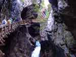
This walk is in Kaprun, a few km south west of Zell am See. It visits the hydroelectric power plant next to the entrance of the Sigmund Thun Klamm. It then goes along the Gorge (cost €3.20 in 2007) to the small Klamsee and then to the valley station of the Kitzsteinhorn lift. Return along past Klamsee to Kaprun. |
|
|
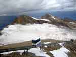
The Kitzsteinhorn mountain at just over 3200m in Kaprun is one of Austria’s summer skiing glaciers. There are three lifts to get you to the summit station and restaurants at 3029m. You can go through a tunnel to a viewing area and walk along a glacier path. From the middle station there are a number of walks. |
|
|
Alexander Enzinger Weg, Kaprun The Alexander Enzinger Weg in Kaprun is part of the long distance Arnoweg. The walk starts at the second stage of the Kitzsteinhorn lifts from the Alpincenter. It heads along the ridge, sometimes just below, sometimes on top with a rope for safety, descending to the top station of the Maiskogelbahn and then to Kaprun. |
© 2005-2025
A Fielding
All Rights Reserved
|
|
| Subscribe to Hiking Alps |
| Visit this group |
